

Description
The FURUNO GP39 is a dedicated GPS/WAAS navigator for operators who want a reliable position, waypoint and route instrument without the complexity of a full chartplotter. Its 4.2-inch colour LCD, external GPS antenna and physical controls make it particularly well suited to workboats, commercial craft, fishing vessels and recreational boats that value a dedicated navigation data source or a dependable backup navigator.
- GPS/WAAS/SBAS positioning: Uses a dedicated GPS receiver with satellite-based augmentation support for dependable marine position fixing.
- 4.2-inch colour LCD: Compact display shows plotter, highway, steering, navigation-data and satellite-status information in clearly defined formats.
- Large waypoint and route memory: Stores up to 10,000 waypoints and 100 routes, with up to 30 waypoints per route.
- 3,000-point track memory: Records vessel movement for return navigation, fishing-reference work and operational review.
- NMEA 0183 integration: Can distribute position/navigation data to compatible radios, sounders, radar, autopilots and other legacy marine electronics.
Dedicated Navigation Instead of Full Cartography
The GP39 is intentionally different from a modern MFD. It does not depend on detailed electronic chart cartography to perform its core job. Instead, it provides accurate position, route and waypoint navigation using simple plotter and steering presentations. For a commercial operator or skipper who wants a dedicated GPS instrument that remains available even when the main MFD is busy with radar or sonar, that simplicity can be a major advantage.
Waypoint, Route and Track Capacity
Furuno provides substantial memory for a unit in this class: up to 10,000 waypoints, 100 routes and 3,000 points of vessel track. A route can contain up to 30 waypoints. This allows fishermen to maintain a large library of marks and working areas, while cruisers and workboats can retain commonly used approaches, harbour points and operational routes.
Multiple Display Modes
The GP39 can show information in several numerical and graphical formats. Plotter view provides a simple track/waypoint picture; Highway and Steering views help the operator understand cross-track position and direction to the next waypoint; navigation-data pages emphasize numerical information; and the satellite-monitor view is useful for checking receiver status. Furuno also provides user-customizable display pages so the operator can prioritize the data most important to the vessel.
Sharing Position with Other Equipment
A dedicated GPS is often most valuable when it acts as a position source for other onboard systems. The GP39 uses NMEA 0183 for data exchange and can feed compatible VHF radios, radar, sonar, fish finders and autopilot systems. It can also receive TLL target latitude/longitude information from compatible sounders or sonars, allowing the operator to turn a detected fish-school or target position into a navigation mark.
Importing and Exporting User Data
Waypoint and route data can be transferred using a USB flash drive or suitable data-conversion arrangement. That makes it easier to back up valuable fishing marks before service work or migrate data when equipment is replaced. For professional users, maintaining a separate backup of routes and waypoints is strongly recommended because those data can be more valuable than the display itself.
External Antenna Configuration
This package includes the Furuno GPA-017 external GPS antenna with 10 m cable. The antenna should be mounted where it has an unobstructed view of the sky and is separated from strong transmitting antennas. Because the receiver is in the GP39 display, the GPA-017 acts as the satellite antenna rather than as a network data source.
Where the GP39 Fits Today
For a new pleasure-boat helm that needs detailed cartography, radar networking and sonar, a modern MFD will do far more. The GP39 remains relevant when the priority is a dedicated GPS navigator, a separate backup position display, simple route steering, or compatibility with existing NMEA 0183 equipment. That is particularly common on commercial and workboat installations where independent navigation sources are valued.
What’s in the Box
- GP39 GPS/WAAS navigator
- GPA-017 GPS antenna with 10 m cable
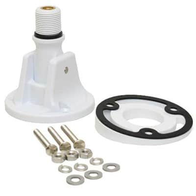
- Mounting bracket and knobs
- Power/data cable
- Standard installation materials and documentation
Specifications
- Display: 4.2-inch colour LCD
- Receiver: GPS with SBAS/WAAS capability
- Waypoints: Up to 10,000
- Routes: Up to 100, up to 30 waypoints each
- Track: Up to 3,000 points
- Display modes: Plotter, Highway, Steering, NAV data, Satellite Monitor and user-customized pages
- Data interface: NMEA 0183
- User-data transfer: USB / compatible data-conversion method
- Power: 12–24 VDC
- Included antenna: GPA-017 with 10 m cable
- Application: Dedicated GPS navigation, waypoint/route management and network position source





Reviews
There are no reviews yet.