


Description
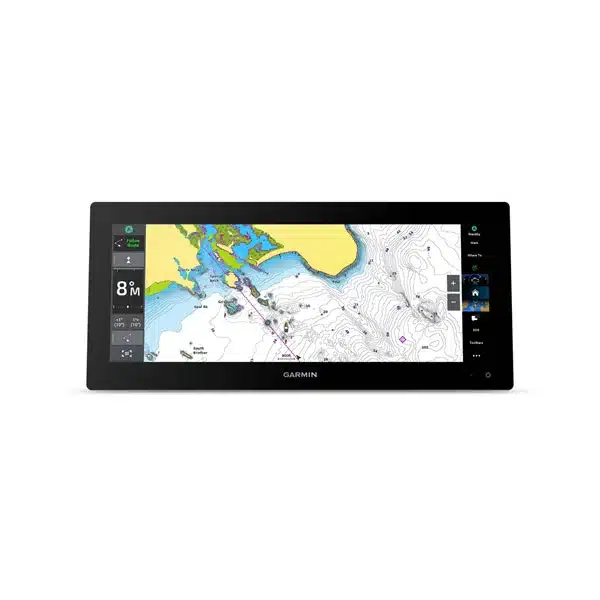
The GARMIN GPSMAP 1543xsv is a 15-inch marine chartplotter for integrated navigation and vessel systems. It combines Garmin Navionics+ mapping, a responsive touchscreen interface, radar and NMEA 2000 integration, and built-in CHIRP and scanning-sonar support.
Main Features
- 15-inch sunlight-readable touchscreen
- Garmin Navionics+ marine charting and route-planning support
- Garmin Marine Network and NMEA 2000 system integration
- Radar, AIS, autopilot and compatible sensor integration
- Built-in sonar capability for compatible transducers
Navigation
GPSMAP is Garmin’s full-network chartplotter platform, intended for boats that need more than basic mapping. It can combine charting with radar overlays, AIS targets, autopilot control, engine and instrument data and other supported Garmin marine functions.
Marine networking
Compatible Garmin Marine Network and NMEA 2000 connections allow the display to share information with radar, sonar, cameras, autopilot components, VHF/AIS equipment and vessel sensors. This makes the unit suitable for multi-function and multi-display installations.
Sonar and fishing
The xsv model includes an internal sounder and supports compatible traditional CHIRP and scanning-sonar transducers, with additional LiveScope capability through the appropriate system.
Choosing this model
The 15-inch format balances screen area and helm space. Choose the xsv version when a built-in sounder is required; choose the non-xsv version when sonar is handled elsewhere on the network.
Charts, route planning and updates
A chartplotter should be evaluated as much for its cartography as for its screen. Garmin Navionics+ packages combine coastal and inland coverage with Garmin navigation features, and supported chart subscriptions can provide updated chart content and premium mapping tools. Mariners should still compare electronic chart information with official notices, local knowledge and current conditions; route suggestions are planning aids, not a substitute for safe navigation.
Radar, AIS and collision-awareness integration
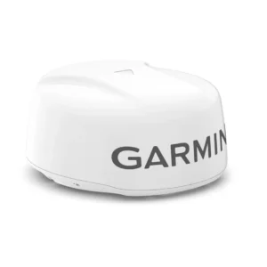
A networked GPSMAP can become the central display for compatible Garmin radar and AIS information. With suitable heading data, radar can be overlaid on the chart to help the operator compare charted features with live radar returns. AIS targets can add vessel identity, course and speed information. Radar and AIS are complementary aids: neither replaces visual watchkeeping, appropriate radar interpretation or compliance with collision regulations.
Autopilot and vessel data
Through NMEA 2000 and supported Garmin interfaces, GPSMAP can display information from compatible engines, tank sensors, wind/depth instruments, heading sensors and Reactor autopilots. A properly commissioned autopilot can receive navigation guidance from the chartplotter, while the operator retains responsibility for steering supervision and route safety. This integrated approach is one of the main reasons to choose GPSMAP over a basic stand-alone fishfinder.
Expansion and software ecosystem
Garmin marine systems can be expanded over time with compatible sonar modules, LiveScope systems, radar, cameras, VHF/AIS equipment, Fusion audio and other supported devices. ActiveCaptain and Garmin software tools provide selected update, planning and mobile-integration functions. Exact capabilities depend on the display generation and connected equipment, so system compatibility should be checked by part number before a refit.
Installation planning
Before purchase, measure the helm cutout and available rear clearance, confirm 12/24 V power capacity, network architecture and cable routing, and decide whether the display will be bail-mounted or flush-mounted. High-bandwidth network devices should be wired according to Garmin’s BlueNet or legacy Marine Network topology for the specific generation. Sonar installations also require the correct transducer connector, power rating, frequency range and mounting style.
Ultrawide helm format
The 1543xsv uses a 15-inch ultrawide display, giving the operator a broad workspace for split-screen chart, sonar, radar and vessel-data combinations without moving to a much taller display. That shape can be particularly useful in retrofit helms where vertical space is limited. Its internal 1 kW sounder makes it a strong all-in-one choice when sonar is part of the installation.
What’s in the Box
GPSMAP display, power/data cable, mounting hardware, protective cover where supplied, NMEA/network accessories as package-specific, and documentation. Transducer is included only when the specific bundle title states it.
Specifications
- Display: 15-inch sunlight-readable touchscreen
- Charts: Garmin Navionics+
- Sonar: Built-in sonar on xsv model
- Networking: Garmin Marine Network and NMEA 2000
- Radar: Compatible with supported Garmin marine radar
- Use: Integrated navigation, sonar, radar and vessel data






Reviews
There are no reviews yet.