


Description
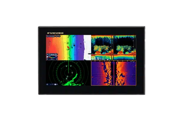
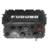
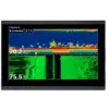
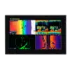
The FURUNO TZT13X is a premium 13.3-inch NavNet TZtouchXL multi-function display built around two ideas: a highly integrated networked electronics platform and dependable hybrid control. Its 1920 x 1080 IPS multi-touch display is paired with dedicated physical controls, so the operator can work directly on the touchscreen in normal conditions or use tactile controls when the boat is moving hard, gloves are being worn or precise input is preferable. The TZT13X combines TZ MAPS charting, internal GNSS, a built-in 1 kW TruEcho CHIRP/CW fish finder and CHIRP Side-Scan with gigabit NavNet networking for compatible Furuno radar, sonar, cameras, AIS, autopilot, heading sensors and other vessel systems.
- 13.3-inch Full HD hybrid-control IPS display: 1920 x 1080 resolution, approximately 900 cd/m² typical brightness and dedicated physical controls provide a high-end helm interface that is usable by touch or tactically by hand.
- NavNet TZtouchXL networking: A gigabit Ethernet-based architecture supports a scalable multi-display Furuno system with compatible radar, sonar and other network resources.
- Built-in 1 kW TruEcho CHIRP/CW sounder: Drives compatible conventional or CHIRP transducers without requiring a basic external sounder module, while still allowing expansion to specialized network sonar.
- Built-in CHIRP Side-Scan: Supports Furuno 230 kHz- or 455 kHz-class Side-Scan transducers with structure imaging up to 750 ft each side under suitable conditions.
- Advanced chart, radar and safety tools: TZ MAPS, BathyVision, supported AI routing, NXT radar target-analysis functions and advanced TZtouchXL software features create a genuinely integrated navigation and fishing workstation.
Hybrid Controls for Real-World Helm Use
Many premium MFDs rely almost entirely on touch input. TZT13X adds dedicated physical controls beside the screen, giving the skipper an alternative when the boat is pounding through chop, the display is wet or the operator simply prefers tactile control for zooming, cursor work and menu selection. This is one of the major reasons to step up from the all-touch TZtouchE models. The interface still supports fast multi-touch gestures and Furuno’s edge-swipe menus, so the operator can move between direct touch and physical control rather than choosing one or the other.
TZ MAPS and Bathymetric Detail
TZ MAPS is designed to make the chart a configurable information layer rather than a fixed electronic paper chart. Depending on the chart package and coverage, the TZT13X can work with vector, raster, satellite and high-resolution bathymetric information, and it can apply custom depth-colour shading to make shoals, channels, ledges and depth bands easier to interpret at a glance. BathyVision can display very fine contour spacing where the underlying dataset supports it, which is particularly valuable for anglers looking for subtle bottom transitions and for cruisers evaluating anchoring or route options.
Supported TZ MAPS purchases can unlock AI Routing, which considers the vessel’s entered draft, charted depths and known obstacles while generating a suggested route. TimeZero account integration can back up routes and waypoints, while compatible chart purchases can be used with the TZ iBoat mobile planning environment. As with any electronic route-planning aid, the proposed route is a planning tool and must be checked by the operator against current charts, notices, tides, weather and actual navigational conditions.
Internal GNSS and Navigation Data
For installations that do not already have a dedicated external position source, the TZT13X includes a 72-channel GPS receiver plus SBAS/WAAS reception. Furuno specifies a 10 Hz position update, approximately 100 seconds for a cold-start fix and nominal accuracy of about 10 m with GPS, 7 m with MSAS and 3 m with WAAS under specified conditions. The chartplotter stores up to 30,000 user points, 100,000 ship-track points and 200 planned routes with as many as 500 points per route.
A serious networked helm will often add a dedicated heading source such as a Furuno satellite compass. Accurate heading improves radar overlay, target presentation and autopilot performance because course-over-ground from GPS is not the same thing as instantaneous vessel heading. The TZT13X is therefore best viewed as the hub of a system whose sensors are selected according to the vessel’s mission.
Built-In TruEcho CHIRP / CW Fish Finder
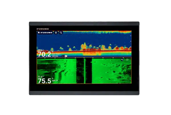
The TZT13X incorporates a 1 kW-class fish finder supporting conventional 50/200 kHz and compatible CHIRP transducers across approximately 40–240 kHz. Depending on the transducer, power class and installation, it can be used for everything from shallow-water bottom definition to serious offshore fish finding. Supported modes include TruEcho CHIRP, ACCU-FISH, Bottom Discrimination, automatic gain, A-Scope, Marker Zoom, Bottom Zoom and Bottom Lock; some functions require a compatible dual-frequency or CHIRP transducer.
Importantly, the built-in sounder does not limit future expansion. A TZtouchXL network can incorporate compatible Furuno external sonar and fish-finder modules for higher power, multibeam or specialized applications. That means an owner can use the internal sounder initially, then add equipment such as compatible DFF-series or DFF3D network sonar as fishing requirements become more demanding.
CHIRP Side-Scan
A dedicated 12-pin Side-Scan port supports 230 kHz- and 455 kHz-class Furuno CHIRP Side-Scan transducers. Side-Scan covers the water and bottom well away from the vessel’s track, which makes it a high-value search tool when trying to locate structure efficiently rather than driving directly over every target. Furuno specifies up to 750 ft of displayed range on each side under suitable conditions and offers multiple transducer styles, including transom and thru-hull options. Supported NavNet displays can use Side-Scan information across the network according to system configuration.
Radar: From Basic Detection to NXT Safety Features
TZT13X supports Furuno’s broad NavNet radar family, from compact radomes to higher-power open-array sensors. The radar experience depends on the chosen antenna/sensor. With compatible NXT solid-state Doppler radar, Furuno can provide features such as Target Analyzer and fast target tracking, designed to make moving traffic easier to interpret quickly. Traditional CPA/TCPA and guard-zone concepts remain important, but the TZtouchXL environment also supports newer collision-awareness tools when the required radar and software are present.
Furuno’s Risk Visualizer evaluates detected targets around the vessel and presents potential collision threats graphically rather than forcing the operator to interpret only lists of numbers. With compatible sensor/chart/system data, AI Avoidance Route can use radar information to help generate a route around detected hazards. These are advisory aids; they do not replace a proper lookout, the COLREGs or the skipper’s responsibility for collision avoidance.
Weather, Dynamic Mooring and Software Capability
Current TZtouchXL software includes TZ Weather, which can display free NOAA GFS forecast information and supported premium weather data. Furuno has also added Dynamic Mooring, which combines forecast information with chart/topographic context to help assess how exposed a potential mooring or anchorage may be to expected conditions. These software-driven features are a good example of why a premium MFD should be evaluated as an evolving platform rather than only by the specifications printed on the box at launch.
NavNet Networking and Third-Party Integration
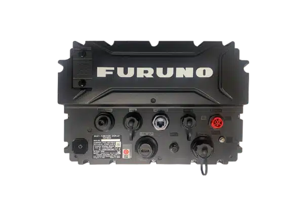
The TZT13X provides a 1000BASE-T Ethernet port for high-speed NavNet networking, NMEA 2000 for vessel sensor data, a serial NMEA 0183 output, USB 3.0 control-unit connectivity, microSDXC storage, built-in Wi-Fi and other video/auxiliary interfaces defined by the installation. Compatible IP cameras and supported video sources can be integrated, and Furuno provides system paths for AIS, satellite compass, NavPilot autopilot, instrument data and engine information. The exact wiring architecture should be designed around the complete electronics package rather than added piecemeal after the MFD is installed.
Remote Controls and Multi-Display Helms
Even though the TZT13X has its own physical controls, Furuno MCU006 and MCU006H remote controllers can add another tactile control point at a captain’s chair, second steering position or fishing station. In a larger NavNet installation, supported remote controllers can switch the display being controlled. This is especially useful when the helm contains multiple displays or when screens are mounted farther away than comfortable touchscreen reach.
Who Should Choose TZT13X?
TZT13X is aimed at the buyer who expects the MFD to be a long-term hub for a premium Furuno system. Compared with TZMAP13, it provides true NavNet networking and far greater system expansion. Compared with TZT13E, it adds the higher-end TZtouchXL platform and integrated hybrid controls. It is therefore a strong choice for offshore fishing boats, larger cruisers, commercial-style recreational helms and refits where radar, sonar, autopilot, heading, AIS and video will be treated as one coordinated navigation system rather than separate instruments.
What’s in the Box
- TZT13X NavNet TZtouchXL 13.3-inch hybrid-control MFD
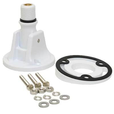
- Tabletop mounting bracket and knobs / mounting components as supplied
- Protective display cover
- Power cable assembly and fuse / installation electrical components as supplied
- Network/LAN installation cable components as supplied for the package
- Flush-mount gasket, hardware and mounting template/materials
- Chart media supplied for the market/region
- Cleaning cloth and operator / installation documentation
Specifications
- Series: NavNet TZtouchXL
- Display: 13.3 in colour TFT multi-touch IPS LCD with integrated hybrid physical controls
- Resolution: 1920 x 1080 Full HD
- Typical brightness: 900 cd/m²
- Display colours: Up to 16.77 million for chartplotter presentation; 64 colours for radar/fish-finder presentation
- Cartography: TZ MAPS, MM3 Vector, CMOR-capable in supported U.S. applications, plus supported raster/satellite/bathymetric data
- User memory: 30,000 user points; 100,000 track points; 200 planned routes x 500 points
- Internal GPS: 72 channels plus 1 SBAS/WAAS channel; L1 1575.42 MHz
- Position update: Up to 10 Hz
- Approx. cold-start TTFF: 100 seconds
- Nominal GPS accuracy: 10 m GPS / 7 m MSAS / 3 m WAAS under specified conditions
- Built-in fish finder: TruEcho CHIRP/CW, up to 1 kW with compatible transducer
- CW frequencies: 50/200 kHz
- CHIRP range: Approx. 40–240 kHz, transducer dependent
- Fish-finder range: Approx. 2–1200 m under appropriate conditions
- Side-Scan: CHIRP 220–240 / 445–465 kHz classes with compatible 230/455 kHz transducer
- Side-Scan range: Up to 750 ft each side under suitable conditions
- NMEA 2000: 1 port
- Ethernet: 1 x 1000BASE-T NavNet LAN
- NMEA 0183: 1 serial output
- USB: USB 3.0 control-unit interface
- Wireless LAN: IEEE 802.11 b/g/n
- Memory: microSDXC slot
- Transducer connections: 1 x 12-pin CHIRP/CW; 1 x 12-pin Side-Scan
- Remote control: Supports MCU006 / MCU006H and other compatible Furuno control options
- Environmental rating: IP56
- Operating temperature: Approx. -15°C to +55°C
- Relative humidity: 93% or less at +40°C
- Power: 12–24 VDC, approximately 3.9–1.9 A
- Approx. mass: 4.1 kg flush-mount configuration; approx. 5.4 kg tabletop/bracket configuration
- Radar, transducers and network sensors: Sold separately